Remnants of the Sharpsville & Oakland Railroad As Seen From The Air

Here we have traces of the Sharpsville & Oakland railbed looping through the center of the picture just northeast of Sharpsville and just south of Shenango Dam, where it linked to the Erie & Pittsburgh Railroad. At the bottom, it crosses Lamor Road (PA 518) just west of Trout Island Road.

This is the area surrounding Hofius, Lamor, and Trout Island Roads. The railbed, which is fairly well marked, proceeds southeast toward Clarksville Road from here.
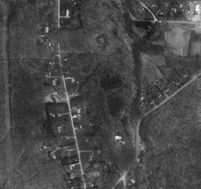
This is a shot between Lamor Road at the top and Clarksville Road at the bottom. Hofius Road is on the left hand side of the railbed, which crosses Clarksville Road where it intersects Dutch Lane.
South of Clarksville Road, all visible traces vanish as we enter the Hermitage Business District. The railbed continues southeast, passing through the area presently occupied by Hermitage Middle School and the Shenango Valley Mall. No more traces can be seen from the air until we reach a location just south of Morefield Road. Traces again become prominent in the vicinity of New Virginia.

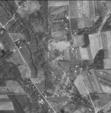
This is an overview of the New Virginia area with Keel Ridge Road running top to bottom through the center, Virginia Road at the top and Miller Road at the bottom. The railbed of the Sharpsville and Oakland Railroad is visible, making an S shape beginning at the upper left corner, crossing Keel Ridge Road just below Virginia Road, and looping to the lower right corner, crossing Miller Road. Just east of Keel Ridge, there is a switch, where a spur branches off from the mainline railbed moving toward the village of Neshannock .
This is a closeup of the switch seen in the above photo. Here, a spur proceeds eastward toward the village of Neshannock, while the mainline railbed loops toward the southeast. The large building at the top of the photo is located just off of Virginia Road.
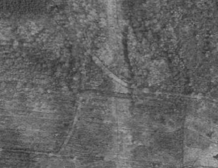
The area just west of Keel Ridge Road, where the Sharpsville & Oakland railbed comes down out of the northwest (from the Hermitage Business District) and loops to the east, showing the southern spur that once led to the Oakland Coal Mine.

This photo shows an area just south of Virginia Road, just west of Neshannock Road. Note the traces of the old railbed running diagonally through the picture from the lower left to the upper right.
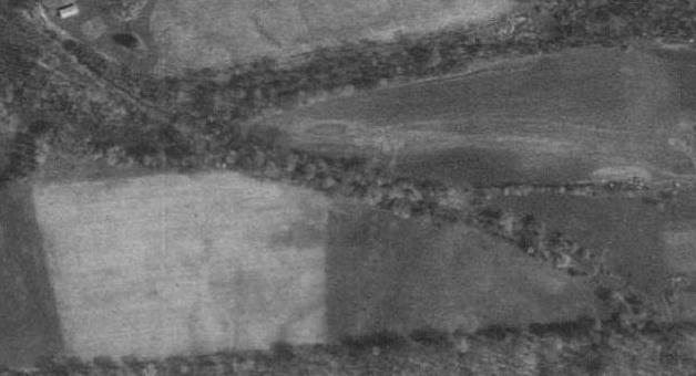
This is an area between Virginia and Miller Roads. The railbed emerges from the top left corner and loops through to the bottom right. Another spur switches off near the top, proceeding to the east toward Neshannock Road.

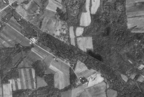
In this photo, Keel Ridge and Neshannock Roads converge at the top and cross the West Middlesex - Mercer Road (PA 318) at the village of Bethel. Further south, below the village, we see the remnants of the railbed as it proceeds in a roughly southeast direction along the banks of the West Branch Little Neshannock Creek (Carbon Creek), crossing under Interstate 80 at the bottom. The Bethel train station still exists as a residence on PA 318.
This photo displays the area between the Charleston and Pulaski - Mercer Roads. The railbed is very clearly visible along Carbon Creek, running more or less parallel to the Bethel - New Wilmington Road on the left hand side.
Finally, we see an area just north of the Lawrence County line near New Wilmington. The railbed continues to follow Carbon Creek in a southeastern direction. Just north of New Wilmington, it loops back to the south, passing through both New Wilmington and Neshannock Falls, where it linked up with the old New Castle & Franklin Railroad.
Aerial images courtesy of Microsoft Terraserver